Nuclear Testing sites
These maps show Pacific Island nuclear test sites from 1946 up to the 1990s, and also the layout of Christmas (Kiritimati) Island, which was used as a British base for Operation Grapple in 1957 and 1958.
Waddingham, John (2017) Maps [Pacific Nuclear Test Sites, 1946–96, Christmas (Kiritimati) Island, 1957–58], in Grappling with the bomb : Britain’s Pacific H-bomb tests by Nicholas Maclellan, Canberra, ANU Press, https://press-files.anu.edu.au/downloads/press/n2626/html/maps.xhtml?referer=&page=5#
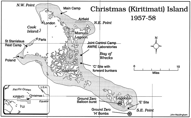
Christmas Island
These maps show Pacific Island nuclear test sites from 1946 up to the 1990s, and also the layout of Christmas (Kiritimati) Island, which was used as a British base for Operation Grapple in 1957 and 1958.
Waddingham, John (2017) Maps [Pacific Nuclear Test Sites, 1946–96, Christmas (Kiritimati) Island, 1957–58], in Grappling with the bomb : Britain’s Pacific H-bomb tests by Nicholas Maclellan, Canberra, ANU Press, https://press-files.anu.edu.au/downloads/press/n2626/html/maps.xhtml?referer=&page=5#